Chronological Timeline of King’s Lynn
1100 Years of King’s Lynn History
Before 1100 – Lynn’s Saxon Beginnings
- c. 9th–11th centuries: A small coastal community forms around tidal lagoons between the Millfleet and River Nar.
- Economy based on fishing, salt-making, and small-scale trade. The area lies close to the Wash before later silting.
1100–1150 – Founding of the Medieval Town of Lynn
- 1100: Bishop Herbert de Losinga (of Norwich) founds a new town on reclaimed land north of the Saxon settlement.
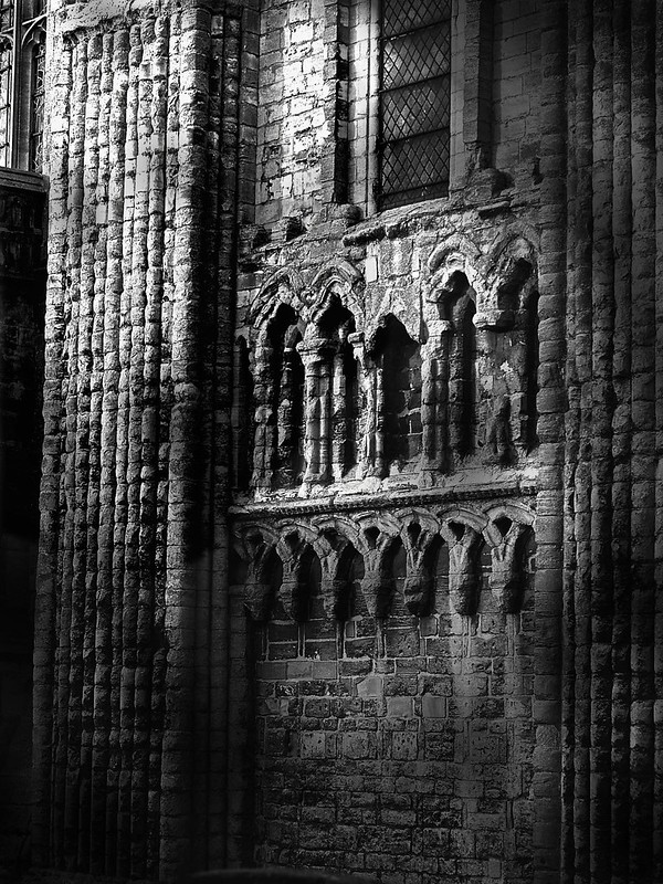
- Begins construction of the Priory Church of St Margaret (now King’s Lynn Minster).
- Establishes the Saturday Market Place as the main market area.
- Lenne Episcopi or Bishop’s Lynn.
- Town located between Millfleet and Purfleet, with streets following the riverbanks.
© James Rye 2015
1150–1300 – Lynn’s Expansion under Episcopal Patronage
- c.1150: Bishop Turbe extends the town northwards, creating the “newe lands” between the Purfleet and Fisherfleet.
- Establishes Tuesday Market Place and St Nicholas’s Chapel.
- 1204 King John’s Charter giving the town some independence.
- C13th Diversion of the River Great Ouse from Wisbech to Lynn.
- 1230–1293: Arrival of five orders of friars (Greyfriars, Whitefriars, Blackfriars, Austin Friars, Friars of the Sack).
- 1290s: Original earthwork defences replaced by brick and flint town walls running south to the Purfleet.
- Town prospers as a major East Anglian port; continental trade flourishes, especially in wool exports and Gascon wine imports.
1300–1500 – Lynn’s Hanseatic Era
- Lynn’s prosperity reaches a peak; by the late 14th century it ranks as England’s third largest port (after London and Southampton).
- Construction of merchant halls and warehouses (and Red Mount), including:
- Hampton Court (14th–17th c.)
- Clifton House (13th–17th c.)
- Thoresby College (c.1510)
- Hanseatic Warehouse, St Margaret’s Lane (c.1475)
- The Red Mount (1485)
- St George’s Guildhall (c.1410)
- Defensive earthworks strengthened; river gradually shifts west, freeing new land for building along Nelson Street, St Margaret’s Place, and Queen Street.
Photo © James Rye 2021
1500–1600 – Reformation and Local Autonomy: King’s Lynn
- 1530s–40s: Dissolution of the monasteries; St Margaret’s Priory and friaries suppressed.
- Greyfriars Tower survives as a navigation landmark.
- 1545: Tower formally acquired by the Corporation as a seamark.
- Growth of merchant governance; town increasingly ruled by wealthy traders operating from the Trinity Guildhall.
- No longer Bishop’s Lynn, but Lynn Regis or King’s Lynn
- Construction of fine brick houses with L-shaped or courtyard plans along the riverfront.
- 1555 Gaywood incorporated into the borough of King’s Lynn.
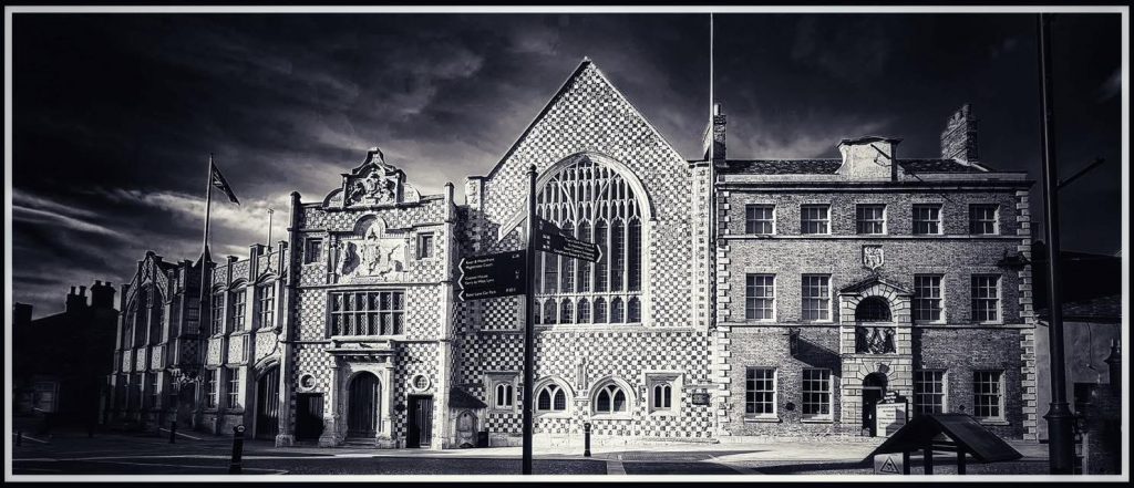
Photo © James Rye 2025
1600–1750 – King’s Lynn’s Prosperity and Georgian Refinement
- 1643 The Siege of Lynn
- 1670s: Henry Bell produces his detailed plan of the town, showing a fully built-up St Margaret’s quarter. Builds Custom House and Duke’s Head.
- 1741: Storm damages St Margaret’s Church; south-west spire collapses, leading to rebuilding of the nave (1742–46).
- 1750s–1760s: The Walks created as a public promenade — among England’s earliest municipal parks.
- 18th century: King’s Lynn and Yarmouth become England’s main grain-exporting ports.
- Wealth visible in Georgian façades added to older houses on King Street and Queen Street.
- 1774-1821 Development of a small Whaling Industry.
1800–1880 – King’s Lynn’s Industrialisation and Rail Expansion
- 1803–06: London Road constructed, opening access to southern suburbs.
- 1821: The Eau Brink Cut and the 1853 Estuary Cut.
- 1830: John Wood’s town plan shows two fleets still open waterways.
- 1844: Railway reaches Lynn, diverting much trade from the river.
- 1869: Alexandra Dock built north of Fisher Fleet to take deep-draught ships.
- 1883: Bentinck Dock opens; docks linked by rail.
- Growth of engineering works and shipyards (Savage’s, Aickman’s, Dodman’s, Cooper Bearings).
- The Walks extended with Town Wall Walk (1800–27), later joined by St James’s Park (1903) and St John’s Walk (1906).
1880–1914 – King’s Lynn’s Late Victorian and Edwardian Town
- Public buildings constructed: schools, hospitals, almshouses, and civic buildings (e.g. 1904–05 Carnegie Library).
- South Quay (1855) rebuilt with permanent brick and stone quay walls and mooring bollards.
- Expansion east of the old town with new terraced housing and improved sanitation.
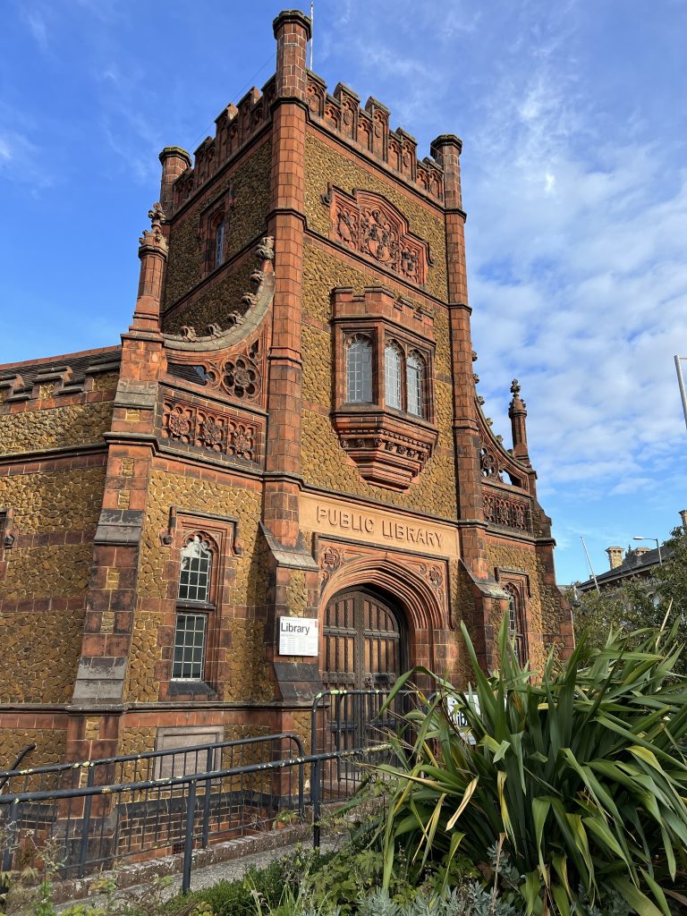
Photo © James Rye 2023
1914–1945 – King’s Lynn’s Early 20th Century and Interwar Years
- Decline in maritime trade; town shifts toward food processing and light industry.
- 1921: War Memorial erected in Tower Gardens.
- 1938: New Head Post Office built on Blackfriars Street.
- Urban housing shortages persist; small terraces and yards become overcrowded.
1945–1970 – King’s Lynn’s Redevelopment and Overspill Growth
- 1958: Campbell’s Soup Factory opens in South Lynn, emblem of the new food industry.
- 1962: London Overspill Scheme doubles population target from 25,000 to 50,000; major housebuilding at Gaywood, North Lynn, and South Lynn.
- 1960s redevelopment: Roughly one-fifth of historic King’s Lynn demolished, mainly between London Road and High Street.
- 1969: King’s Lynn Conservation Area designated, covering St Nicholas’s and St Margaret’s quarters.
- Early 1960s–70s: King’s Lynn Preservation Trust restores key medieval properties; archaeological excavations begin.
1970–2000 – King’s Lynn’s Conservation and Regeneration
- 1979: Conservation area extended after a detailed historic zoning study.
- 1983: Article 4 Direction introduced to restrict unsympathetic alterations (e.g. uPVC windows, concrete tiles).
- 1980s–1990s: Regeneration of redundant warehouses into homes and offices.
- 1990: Caisson bridge installed at Boal Street; new promenade paving at South Quay.
- 1999–2000: King’s Staithe Square refurbished; quay developed as a public waterfront.
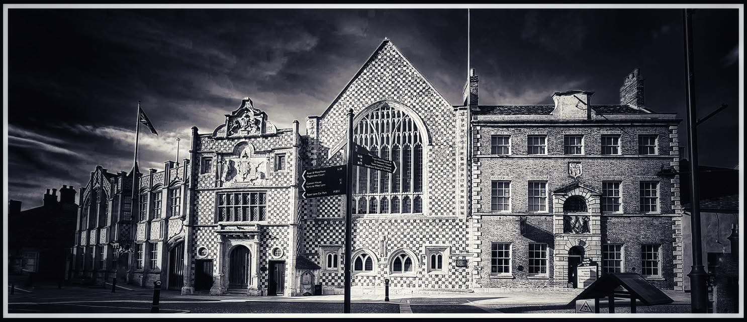
Miscellany
- The Town Hall Complex remained the official meeting place of the King’s Lynn Borough Council until 1974, when local government reorganisation designated it as the headquarters of the newly formed West Norfolk District Council. This was later renamed the Borough Council of King’s Lynn and West Norfolk in 1981.
- St Margaret’s Church was designated as a Minster in 2011.
© James Rye 2025
Book a Guided Tour with a Trained and Qualified King’s Lynn Guide Through Historic Lynn
Sources
- Borough Council of King’s Lynn and West Norfolk St Margaret’s Area Conservation Area Character Statement (2003)
- Rye, J. (2025) http://www.circato.co.uk/