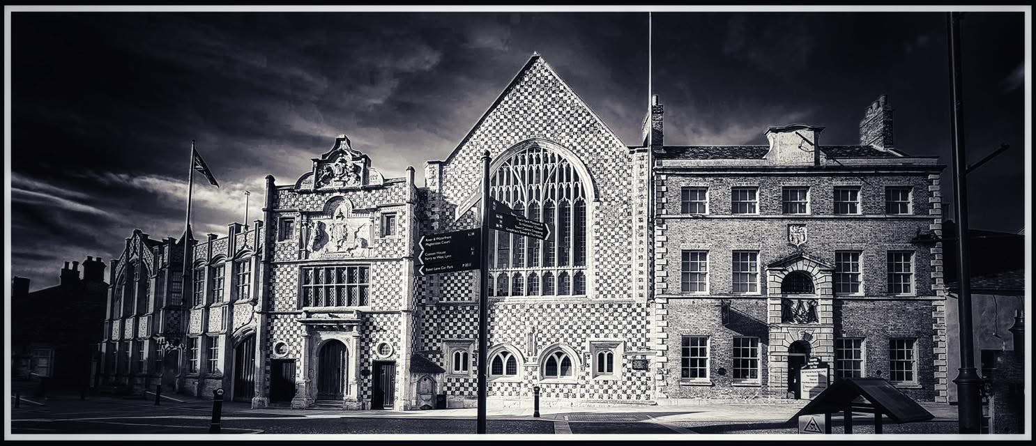
The town beneath the town
King’s Lynn looks solid underfoot. Queen Street, King Street, Saturday Market Place, Tuesday Market Place, Pilot Street, Purfleet Quay, South Quay, London Road, and Southgate Street appear to belong to a town of brick, stone, cobbles, warehouses, and market places. Yet the older town was made by water. The Great Ouse, the Purfleet, Mill Fleet, Fisher Fleet, Friars Fleet, the River Nar, the Gaywood River, drains, sluices, ditches, quays, and reclaimed riverbank shaped Lynn as surely as its churches, guildhalls, and merchants’ houses.
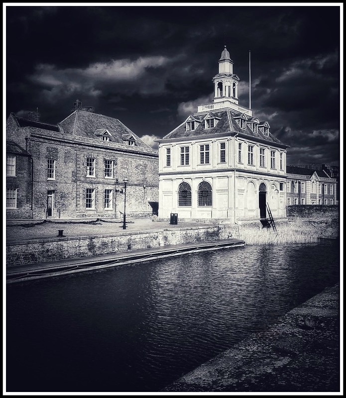
Photo © James Rye 2021
Some waters remain visible. The Purfleet still lies beside the Custom House. Fisher Fleet still serves fishing boats, though not on its medieval line. The Great Ouse still gives Lynn its western face. Other waterways have disappeared beneath streets, yards, and later development. These lost waters explain why Lynn grew where it did, how it traded, how it defended itself, and why parts of its street pattern still seem to bend around things no longer there.
What a fleet was
In Lynn, a “fleet” was not a fleet of ships. It was a creek, inlet, tidal channel, or watercourse. In a low-lying town beside marsh, river, and estuary, such channels drained land, carried boats, marked boundaries, served quays, turned mills, and, in time, became sources of smell, obstruction, and civic complaint.
The names survive most clearly in Purfleet, Millfleet, Fisher Fleet, and Friars Fleet. They remind us that medieval Lynn was not simply a port beside a river. It was a town divided, supplied, and joined by water.
Lynn before the neat quays
Before the planned medieval borough, settlement around Lynn was already shaped by salt water, fishing, coastal trade, and salt-making. The earlier focus lay south of the later commercial centre, around All Saints and South Lynn, near salt-water lagoons bounded by the Mill Fleet to the north and the River Nar to the south.
The great change came with episcopal planning. Bishop Herbert de Losinga founded his new town around 1095 to 1100, with St Margaret’s Priory and the Saturday Market at its heart. This first planned town lay broadly between the Mill Fleet and the Purfleet.
By the middle of the twelfth century, Lynn had expanded again. Bishop William Turbe laid out the Newland north of the Purfleet, with Tuesday Market Place and St Nicholas’s Chapel. The Purfleet was therefore not a minor internal stream. It marked the division between two phases of urban growth: Losinga’s town to the south and Turbe’s Newland to the north.
The Purfleet: boundary, harbour, and survivor
The Purfleet is the clearest surviving fragment of Lynn’s older water system. Today it looks tidy, framed by brickwork, railings, the Custom House, and Purfleet Quay. In the medieval town it was broader, busier, and less polite.
Archaeological work in the twentieth century showed that the Purfleet had once been much wider. It served as one of Lynn’s principal anchorages, bringing boats and small ships into the commercial centre. It was also a landing place for pilgrims travelling through Lynn on their way to Walsingham before the suppression of pilgrimage under Henry VIII.
Purfleet Bridge, at King Street and Queen Street, still marks one of the old crossings between the two halves of the medieval borough. It has medieval origins, and was known as Stone Bridge in the Survey of Newland around 1250. It linked the first and second planned settlements, making it not just a bridge but a joint in the town’s medieval skeleton.
Another crossing, High Bridge or Stone Bridge, once carried High Street over the Purfleet. It was demolished in 1866 during nineteenth-century improvement works. Henry Hillen recorded the filling of the Purfleet as far as High Street, the removal of High Bridge, and the paving of New Conduit Street. The sentence is brief, but the historical loss was large.
The Purfleet did not vanish in one act. Its inland parts were narrowed, filled, bridged, and absorbed into the modern street pattern. The surviving basin beside the Custom House is only a remnant, but it is a powerful one.
The Custom House and the merchant waterfront
No building tells the story of the Purfleet more clearly than the Custom House. Built in 1683 to designs by Henry Bell, it opened as a merchants’ exchange before becoming Lynn’s official Custom House. Its classical dignity can make the Purfleet look almost theatrical, but the building belonged to a hard commercial world of ships, customs officers, merchants, cargoes, cellars, wine, grain, timber, coal, and coastal trade.
The surrounding buildings deepen the picture. Nos. 18 and 19 Purfleet Quay preserve early seventeenth-century quayside warehouse fabric, including cellars used for storage. These were not scenic backdrops to a pretty basin. They were part of Lynn’s port economy.
The Custom House also reminds us that Lynn’s riverfront moved. The river once lay much closer to Nelson Street, St Margaret’s Place, Queen Street, and King Street. As the Great Ouse shifted westward and land was reclaimed, plots lengthened, quays moved, and warehouses followed the water. The modern riverside is not one ancient waterfront preserved in place. It is a series of former edges.
The Mill Fleet: the vanished working edge
South of the Purfleet lay the Mill Fleet, one of Lynn’s most important lost waterways. It helped define the southern side of Losinga’s town and gave its name to Millfleet. Earlier names recorded for the watercourse include Sewoldsfled, Sunolf’s Fleet, Mayor’s Fleet, and Swaggesfleet, before Millfleet became the familiar form.
The Mill Fleet was tied to milling, but it was more than a mill stream. It was tidal, difficult to manage, and connected with wharves and trade. The conservation-area evidence describes Millfleet as, in effect, one continuous wharf. That phrase matters. This was not a rural brook running prettily through town. It was a working frontage.
By the nineteenth century, the Mill Fleet had become a civic problem. Photographs and written accounts show a reduced, muddy channel. Lynn Corporation received complaints about its sewer-like appearance, and the fleet was filled in at the end of the nineteenth century. Hillen says it had ceased to exist by 1897, while the Norfolk Historic Environment Record gives 1898 for its infilling. The small difference probably reflects the distinction between decision, works, and completion. The sequence is clear enough: an old working waterway became a sanitary nuisance, then a buried line.
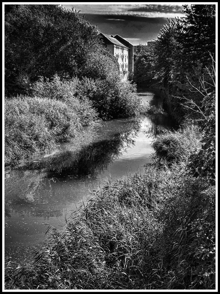
Photo © James Rye 2026
Fisher Fleet: the harbour that moved
Fisher Fleet is easily misunderstood because the name survives and fishing boats still use Fisher Fleet Quay. The present Fisher Fleet is not the medieval Fisher Fleet unchanged. The old channel belonged to the northern edge of Lynn’s North End, while the modern quay is a late nineteenth-century replacement within the dock landscape.
The original Fisher Fleet formed the northern boundary of the Newland. Turbe’s twelfth-century expansion lay between the Purfleet and Fisherfleet. It was also part of the northern defensive and fishing landscape. Hillen gives a useful clue to its position: as late as 1738, Pilot Street was known as Deucehill or Dowshill, and Deucehill Bridge crossed the old Fisher Fleet not far from the military blockhouse on the outskirts of Lynn.
In modern terms, the old Fisher Fleet should be placed by the North End and Pilot Street area, close to the northern approaches to the medieval town, not at the present Fisher Fleet Quay. Its western end was associated with the point where the old northern waters met the Ouse, near St Ann’s Fort.
The old Fisher Fleet was lost during the nineteenth-century transformation of Lynn’s port. Hillen states that it disappeared when the first dock opened in 1869. That dock was Alexandra Dock, opened by the Prince and Princess of Wales on 7 July 1869. The dock age altered the whole northern waterfront, replacing much of the older tidal pattern with enclosed basins, engineered quays, railway access, steam traffic, and industrial port works.
So the Fisher Fleet was not moved in the manner of a bridge or market cross. The older channel disappeared, and a new fishing harbour and quay took over its function and name. The present Fisher Fleet Quay was authorised under the King’s Lynn Dock Acts of 1877 and 1881, and has served the local fishing industry since the late nineteenth century. It was first built in timber, then replaced by a concrete suspended quay in the late 1950s.
Friars Fleet: where exactly was it?
Friars Fleet lay in South Lynn, beside the River Nar. It was not in the northern fishing quarter and not near the Purfleet. Its position can be stated fairly closely.
The useful modern landmarks are Ethel Terrace, Friars Fleet, Gladstone Road, the lower part of Friars Street, Friars Business Centre off Southgate Street, and the River Nar. The conservation-area evidence identifies the roads to the wharves at Friars Fleet as lying along present Ethel Terrace and where the Business Centre on Southgate Street now stands. It also describes Ethel Terrace as a road cutting south to the river on a service road to the River Nar staithes, a line dating back to the fifteenth century.
That places the old Friars Fleet waterfront on the north side of the River Nar, west of Southgate Street and south of Friars Street, in the area now marked by Ethel Terrace, the modern Friars Fleet development, and Friars Business Centre. A modern planning map still labels Friars Fleet on the Nar at this point, and marks a nearby “course of” line close to Wisbech Road and the river bend. The 1932 Britain from Above photograph of Friars Fleet and the town from the south-west is especially useful for visualising this southern waterside before later redevelopment.
The name is also tied to the religious geography of South Lynn. Friars Street follows the irregular line of the Carmelite precinct walls, the Whitefriars having been founded here around 1260. Friars Fleet was therefore not just another quay. It belonged to the southern edge of a district where friary precincts, roads to staithes, boatyards, wharves, and the River Nar met.
The safest description is this: Friars Fleet was the Nar-side wharf and watercourse area reached from Southgate Street by the old service roads represented today by Ethel Terrace and the Friars Business Centre site, immediately south of Friars Street and west of Southgate Street, beside the present River Nar.
The Nar, South Lynn, and the defensive town
The southern waterways also helped defend Lynn. The town’s flint and brick walls were begun in the 1290s and ran as far south as the Purfleet. Southwards towards the South Gates, defence relied on ditches and earthworks fed by rivers, fleets, and linked watercourses.
Friars Fleet and the River Nar belonged to this southern water landscape. They also served working purposes, including wharves, boatyards, and river access. In Lynn, the same water might drain land, protect the town, carry a boat, mark a boundary, serve a quay, and offend the nose.
The river that moved away
The largest lost waterway of Lynn is not a named fleet at all. It is the former course and edge of the Great Ouse.
The west side of the Saturday Market area was once protected by a great bank running roughly along the line of Nelson Street, St Margaret’s Place, and Queen Street. By about 1500, the river had moved about 50 metres west. The making of the new South Quay in 1855 fixed the riverfront still further west. North of the Purfleet, the west side of Tuesday Market Place was once washed by the river, with King Street forming the line of the bank. As the river edge moved, plots were extended and warehouses followed the water.
This explains why parts of Lynn’s historic core can seem too far inland for a medieval port. They were not always inland. The water moved, the banks changed, and the town built over its former margins.
Improvement, health, and forgetting
The loss of Lynn’s waterways was not one story but many. Some channels silted. Some were embanked. Some were narrowed by quays and buildings. Some became foul. Some were deliberately filled. Some were swallowed by dock works, railway works, road schemes, and sanitary improvement.
Nineteenth-century Lynn was especially hard on the old water pattern. High Bridge came down in 1866. Alexandra Dock opened in 1869. The old Fisher Fleet disappeared. The Mill Fleet was filled near the end of the century. The older port of tidal inlets, wharves, creeks, and mud was refitted for a new age of docks, steam, roads, railways, and municipal order.
This was not simply destruction. It was also adaptation. Lynn remained a port because it changed. Yet those changes made the medieval water-town harder to see.
Reading the ghost waters
The Purfleet is still the easiest place to begin. Stand by the Custom House and the older town can still be read: water entering from the Ouse, quayside buildings, a bridge joining two medieval settlements, merchants’ space, and the memory of ships arriving close to Lynn’s heart.
Then look north to Fisher Fleet and remember that the surviving name masks a shift in place and function. The medieval Fisher Fleet belonged to the North End and Pilot Street area. The present quay belongs to the dock age. Look south towards Millfleet, Friars Fleet, and the Nar, and the hidden town becomes wetter again: lost wharves, old mills, drains, defensive ditches, service roads, boatyards, and buried retaining walls.
King’s Lynn has never been only a town beside water. It is a town made out of water’s opportunities and water’s inconveniences. Its lost fleets are not footnotes. They are the old lines under the streets.
© James Rye 2026
Book a Guided Tour with a Trained and Qualified King’s Lynn Guide Through Historic Lynn
References
Associated British Ports. “Proposed Associated British Ports (Fisher Fleet Quay) Harbour Revision Order: Statement of Reasons.” 25 March 2014. URL: https://assets.publishing.service.gov.uk/media/5a7ecb1a40f0b6230268b941/STATEMENT_OF_RE_10995_26_250314141331.pdf
Borough Council of King’s Lynn and West Norfolk. King’s Lynn: The Friars Conservation Area Character Statement. King’s Lynn: Borough Council of King’s Lynn and West Norfolk. URL: https://www.west-norfolk.gov.uk/download/downloads/id/1913/kings_lynn_the_friars_con_area_leafletpdf.pdf
Borough Council of King’s Lynn and West Norfolk. “Adj Harvest House, Wisbech Road, King’s Lynn: Map 1, 19/01758/F.” 2019. URL: https://democracy.west-norfolk.gov.uk/documents/s37272/19.1758.F%20Map%201.pdf
Britain from Above. “EPW039195: Friars Fleet and the Town, King’s Lynn, from the South-West, 1932.” Historic Environment Scotland. URL: https://britainfromabove.org.uk/image/epw039195
Department for Transport. The Associated British Ports (Fisher Fleet Quay) Harbour Revision Order 2014. Statutory Instrument 2014 No. 2933. URL: https://www.legislation.gov.uk/uksi/2014/2933/pdfs/uksi_20142933_en.pdf
Hillen, Henry J. History of the Borough of King’s Lynn. Vol. 1. Norwich: East of England Newspaper Co., 1907. Internet Archive. URL: https://archive.org/stream/historyofborough01hill/historyofborough01hill_djvu.txt
Hillen, Henry J. History of the Borough of King’s Lynn. Vol. 2. Norwich: East of England Newspaper Co., 1907. Internet Archive. URL: https://archive.org/stream/historyofborough02hill/historyofborough02hill_djvu.txt
Historic England. “18–19 Purfleet Quay, Cellars, and Attached Wall to the East, King’s Lynn.” National Heritage List for England. URL: https://historicengland.org.uk/listing/the-list/list-entry/1195415
Historic England. “Customs House Including North Bank of Purfleet Quay, King’s Lynn.” National Heritage List for England. URL: https://historicengland.org.uk/listing/the-list/list-entry/1195414
Historic England. “Purfleet Bridge, King’s Lynn.” National Heritage List for England. URL: https://historicengland.org.uk/listing/the-list/list-entry/1220585
Norfolk Heritage Explorer. “Retaining Wall of Mill Fleet, Stonegate Street.” Norfolk Historic Environment Record. URL: https://www.heritage.norfolk.gov.uk/record-details?Index=976&MNF1133-Retaining-wall-of-Mill-Fleet-Stonegate-Street=
Norfolk Heritage Explorer. “Route of King’s Lynn Harbour Railway.” Norfolk Historic Environment Record. URL: https://www.heritage.norfolk.gov.uk/record-details?Index=12729&MNF13593-Route-of-King%27s-Lynn-Harbour-Railway=
Norfolk Heritage Explorer. “Site of High Bridge or Stone Bridge.” Norfolk Historic Environment Record. URL: https://www.heritage.norfolk.gov.uk/record-details?Index=5018&MNF5476-Site-of-High-Bridge-or-Stone-Bridge=
Norfolk Mills. “King’s Lynn Millfleet Town Watermill.” Norfolk Mills. URL: https://www.norfolkmills.co.uk/Watermills/kl-town-mill.html
Visit West Norfolk. King’s Lynn Maritime Trail. URL: https://www.framlinghamtown.gov.uk/uploads/kings-lynn-maritime-trail-web-version-cep-mp-2022-07-12.pdf?v=1657014896