Anyone passing Gaywood Hall today sees a nineteenth-century house standing among lawns and mature trees. Little above ground suggests that this was once the centre of a large medieval estate belonging to the bishops of Norwich. Beneath and around the present hall, however, lie the remains of an episcopal palace surrounded by moats. Beyond it stretched farmland, pasture, woodland and salt marshes, together with a mill, tenant holdings and a park.
Gaywood was not simply where the bishop kept a convenient country residence. It was a productive lordship and a base from which he could exercise authority over neighbouring Bishop’s Lynn. The estate was already old and valuable before the Norman Conquest, and its history is inseparable from the early growth of the town beside it.
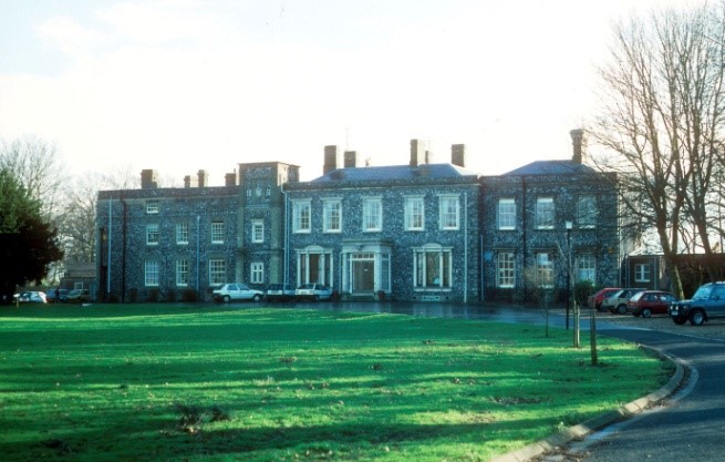
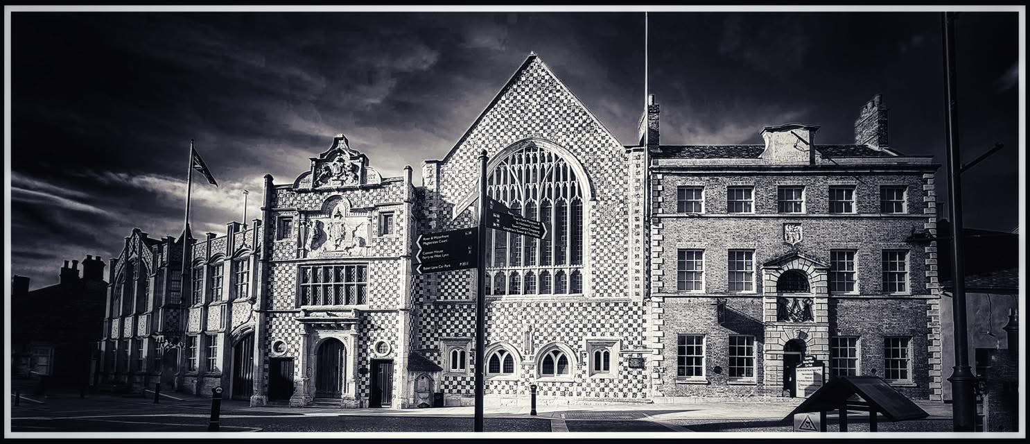
Image King’s Lynn Civic Society
A manor older than Lynn
Gaywood belonged to the East Anglian bishopric before 1066. In the reign of Edward the Confessor it was held by Bishop Almer of Elmham. By the time of Domesday Book in 1086, the bishopric’s seat had moved to Thetford and Gaywood was held by Bishop William de Beaufeu.
Domesday records forty-four households: sixteen villagers, twenty-four smallholders, three freemen and one enslaved person. These were recorded householders rather than the estate’s entire population. With their families and dependants, the number of people living there was probably several times larger.
The estate supported two plough teams belonging to the bishop and another used by the tenants. It contained forty-four acres of meadow, woodland assessed as capable of feeding 160 pigs and a mill. The bishop’s livestock included 190 sheep, twenty-five pigs, three cattle and a cob or riding horse. Gaywood’s annual value had increased from £13 in 1066 to £18 10s by 1086.
These figures describe a substantial working manor. Its most unusual asset, however, was recorded separately: twenty-one salt houses.
Salt beneath modern Gaywood
The Domesday “salt houses” were probably salt-making units rather than twenty-one conventional buildings. Their workers collected salty mud and sand from the tidal flats, washed it with water to form concentrated brine, and then boiled the liquid in shallow vessels. The process consumed fuel and left behind large quantities of filtered sand, burnt clay, ash and charcoal.
Archaeological investigations around Lynnsport have uncovered precisely this evidence. Excavators have found saltern mounds, filtration tanks, hearth waste and fuel-ash slag associated with late Anglo-Saxon and early medieval salt production. Some of the salt workings may have begun as early as the eighth century.
The scale of the industry transformed the landscape. Waste sand from filtration accumulated into mounds, some of them many metres across. Centuries later, the Gaywood Dragge of 1486–87 still named old saltern sites such as Saltushill, Lancelotehill, Beldamshill, Finkinhill, Gorishille, Willyshill and Hibbronds.
A network of creeks and channels crossed the North Marsh. The Dragge recorded names including le Salt Ea, le Bull and le Goole. These waterways supplied salty mud and allowed workers, fuel and finished salt to be moved through otherwise difficult marshland.
Salt was an indispensable commodity. It preserved meat and fish and was used in making butter and cheese. Gaywood’s salt industry therefore supplied more than its immediate inhabitants. It formed part of the commercial environment from which Bishop’s Lynn developed.
It would be too definite to claim that the estate created the town. Lynn grew because of its river, harbour, markets and wider trading connections. Yet the evidence beneath Lynnsport shows that organised production was taking place on the Gaywood marshes before Lynn became a major medieval port.
The palace beside Bishop’s Lynn
The administrative centre of the estate stood near St Faith’s Church, approximately where Gaywood Hall now stands. A residence may have existed there before the thirteenth century, but Bishop John de Grey, who held the see from 1200 to 1214, is credited with building or greatly enlarging the palace.
A medieval episcopal palace was not necessarily one enormous building. It was more commonly a group of structures containing a great hall, private chambers, a chapel, kitchens, stores and accommodation for servants, visitors and estate officials.
The Gaywood palace occupied two moated enclosures. The principal domestic buildings stood within the inner enclosure. The outer area probably contained gardens, yards and service buildings. The moats assisted drainage and controlled entry, while also giving the residence the appearance expected of a powerful medieval lord.
Its position was carefully chosen. The bishop could enjoy a spacious rural residence while remaining close to Bishop’s Lynn. He did not need to depend upon lodgings within a town whose burgesses were increasingly determined to manage their own affairs.
The palace became more formidable under Henry Despenser, the celebrated “Fighting Bishop” of Norwich. On 29 December 1387, Richard II granted Despenser permission to crenellate his houses at Gaywood and North Elmham. The licence allowed him to add battlements and defensive features, although Gaywood should not be imagined as a great stone castle.
Despenser had taken a leading role in crushing the East Anglian rising of 1381. A fortified house offered security, but crenellation was also a public sign of status. The bishop’s residence stood within sight of a town whose inhabitants had repeatedly challenged episcopal control.
A lordship with teeth
The Bishop of Norwich’s authority at Gaywood was not confined to collecting rents. He exercised legal rights through his own officials and manorial court.
The court dealt with the routine affairs of the estate: inheritance, transfers of land, unpaid rents, damaged ditches and straying livestock. Tenants could be fined for failing to perform obligations or for breaking the customs of the manor.
The bishop also claimed broader liberties, including the return of royal writs and the regulation of bread and ale. He maintained his own officers and claimed a gallows, an emblem of serious judicial authority. Possession of a gallows does not show that executions were frequent, but it demonstrated that this was no ordinary landed estate.
Some land was cultivated as demesne, meaning that its produce went directly to the lord. Other parts were occupied by free or customary tenants who paid rent, supplied labour or owed other services. Religious bodies, including Norwich Cathedral Priory, also held land and salt-making rights within the wider lordship.
The bishop’s mill provided another source of income. Domesday records one at Gaywood, almost certainly a watermill, although its precise location has not been firmly established. Medieval tenants could be required to have their grain ground at the lord’s mill and pay a proportion of it as a milling charge.
The Gaywood River was already being controlled through channels, mill works and drainage. Before its diversion along the southern edge of the North Marsh in 1425, it flowed through the marsh itself. Changes to its course altered drainage and helped turn former salt-working ground into valuable pasture.
Church, park, and estate
St Faith’s Church stood beside the palace and formed part of the manorial centre. The bishop possessed the advowson, the right to present a priest to the living when it became vacant.
The Gaywood Dragge described the church, neighbouring pasture and rectory as occupying six acres. A similar six-acre ecclesiastical enclosure can still be recognised on the enclosure map of 1810. This suggests a remarkable continuity in the relationship between church, rectory land and the old palace site.
The estate also contained a park and land over which the bishop claimed hunting rights. Medieval parks were not simply ornamental spaces filled with deer. They supplied timber and grazing, protected game and proclaimed the owner’s rank.
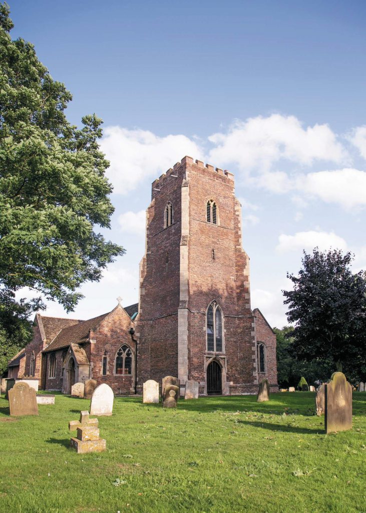
Image King’s Lynn Civic Society
Rights over pasture and woodland were carefully guarded. Neighbouring tenants might be allowed to graze animals while being forbidden to cut wood or take fuel. The manor was divided among many users, but access to its resources remained subject to episcopal authority.
The Gaywood Dragge
The fullest surviving description of the late-medieval estate is the Gaywood Dragge of 1486–87, now held by the Norfolk Record Office. A “dragge” was a detailed written survey or terrier rather than a pictorial map.
It recorded tenants, fields, roads, waterways and boundaries. Lynn burgesses appear among those holding land within the manor, alongside local tenants and religious institutions. By this date, the estate was not one continuous farm worked directly for the bishop. It was a patchwork of holdings united by the bishop’s lordship.
The document also captures a landscape in transition. Much of the North Marsh had become grazing land, while the names of the old salt hills recalled an earlier industrial economy. Channels once used by salt workers remained part of the drainage and transport system.
The Dragge could support much more research. A complete modern transcription linked to present-day mapping might allow lost roads, watercourses and individual holdings to be located with greater precision.
From bishop to king
Episcopal ownership ended during Henry VIII’s reign. In 1536 Gaywood passed to the Crown as part of an exchange made when William Rugg became Bishop of Norwich and Abbot of St Benet’s at Holme. The king acquired a number of valuable episcopal properties, while the bishopric received the heavily indebted abbey and its estates.
Gaywood had probably belonged to the bishopric for at least five centuries. Its transfer marked a decisive break in the history of the manor and coincided with the removal of the bishop’s remaining authority over Lynn.
The estate subsequently passed through several prominent hands. The Crown granted interests in it to the Howard family. During Elizabeth I’s reign it was granted to Edward de Vere, Earl of Oxford, who conveyed it to John Pepys. Pepys soon sold the manor to Thomas Thoresby, a member of an important Lynn mercantile family.
Francis Thoresby sold Gaywood to Sir Cyril Wyche in July 1697. By then the medieval palace was ruinous or had largely disappeared. A later manor house occupied its site, still surrounded by traces of the old moats.
The Bagge family eventually acquired the estate. Richard Bagge built, or substantially rebuilt, the present Gaywood Hall in 1851. The inner moat was filled during the work. Estate maps indicate that much of the outer moat had already vanished, although its northern section may survive as the pond near the hall.
Following the death of Sir Richard Ludwig Bagge in 1933, the estate was sold. Gaywood was incorporated into the Borough of King’s Lynn in 1935. Much of the old park and farmland disappeared beneath streets, schools and the Gaywood Park housing estate.
A palace waiting to be found
The present Gaywood Hall is Victorian, not medieval. Yet it stands over the centre of the bishops’ estate, and excavations undertaken before building work in the 1980s uncovered substantial medieval wall footings.
A resistivity survey detected further buried walls but did not produce a clear plan. Much of the palace site remains unexplored. Foundations of the great hall, chapel, private chambers or service ranges may survive beneath the grounds.
The filled moats could be equally informative. Waterlogged deposits sometimes preserve timber, seeds, leather, food remains and everyday objects that decay on dry sites. Such finds might reveal far more about the people who maintained the bishop’s household than stone foundations alone.
The wider estate survives in fragments. St Faith’s Church remains beside the manorial centre. Gaywood Hall Drive preserves an approach towards the old palace site. The pond, former parkland and buried salt mounds are traces of a landscape that once extended from the bishop’s residence into the North Marsh.
Gaywood was neither a quiet village estate nor merely an episcopal holiday home. It fed the bishop’s household, generated income and supported one of the area’s earliest industries. Its palace allowed him to exercise authority beside a port that was growing richer and increasingly independent.
Modern Gaywood has covered much of that world, but it has not entirely erased it. Beneath its houses, playing fields and lawns lie the remains of a lordship older than King’s Lynn itself.
© James Rye 2026
Book a Guided Tour with a Trained and Qualified King’s Lynn Guide Through Historic Lynn
References
- Blomefield, Francis, and Charles Parkin. “Freebridge Hundred and Half: Gaywode.” In An Essay Towards a Topographical History of the County of Norfolk. Vol. 8, 419–425. London: William Miller, 1808. https://www.british-history.ac.uk/topographical-hist-norfolk/vol8/pp419-425
- Bradfer-Lawrence, H. L. “Gaywood Dragge, 1486–7.” Norfolk Archaeology 24, no. 2 (1932): 146–183.
- Clarke, Graeme. Lynnsport 1: Land South of Aconite Road, King’s Lynn, Norfolk: Archaeological Evaluation. Oxford Archaeology East Report 2213. Bar Hill: Oxford Archaeology East, 2018. https://eprints.oxfordarchaeology.com/4154/7/Report%202213_LR.pdf
- Davies, Philip. “Gaywood Hall, King’s Lynn.” The Gatehouse Gazetteer. Updated 26 July 2017. https://www.gatehouse-gazetteer.info/English%20sites/1953.html
- King’s Lynn Civic Society. “Gaywood.” King’s Lynn Local Heritage List. https://www.kingslynncivicsociety.co.uk/local-list/gaywood/
- Kwiatkowska, M. Late Saxon to Early Medieval Saltern at Lynnsport 3: Land South of Front Way, King’s Lynn, Norfolk. Oxford Archaeology East Report 2380. Bar Hill: Oxford Archaeology East, 2021. https://eprints.oxfordarchaeology.com/6045/1/OAE_Report%202380_XNFFWY18_LR.pdf
- Norfolk Historic Environment Service. “Gaywood Hall: Site of Medieval Bishop’s Palace.” Norfolk Historic Environment Record MNF5555. https://www.heritage.norfolk.gov.uk/record-details?MNF5555
- Norfolk Record Office. Gaywood Dragge, 1486–87. Bradfer-Lawrence Collection, BL/MA 2/2.
- Open Domesday. “Gaywood.” Based on Domesday Book, Norfolk, folio 83, Phillimore reference 10,2. https://opendomesday.org/place/TF6520/gaywood/
- Shiel, D. Resistivity Survey at Gaywood Hall, King’s Lynn, Norfolk. Ancient Monuments Laboratory Report 42/1986. London: English Heritage, 1986. https://historicengland.org.uk/research/results/reports/42-1986