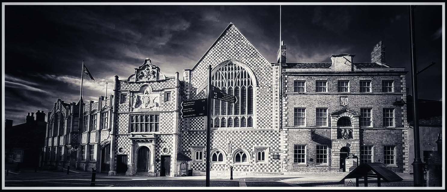
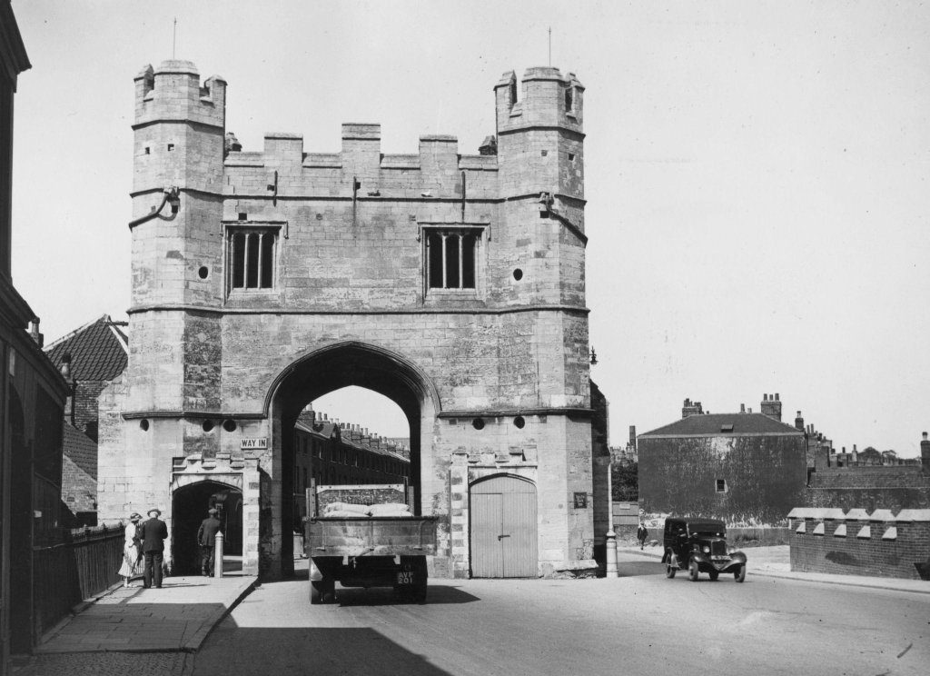
Stand in London Road and look south towards the South Gate. The broad street seems to belong to the medieval gateway. It runs straight towards it, as though the two had been planned together.
They are actually separated by more than three centuries.
The surviving South Gate was built principally in 1437. London Road did not exist until the opening years of the nineteenth century. Before then, a traveller arriving from London or Downham Market passed through the gate and almost immediately turned away from the route we know today. The road wound westwards and northwards through Southgate Street, Friars Street, All Saints Street and Bridge Street before reaching the busier parts of Lynn.
Then, in the first years of the 1800s, the town decided to do something remarkably bold. Instead of improving the old route, it created a new one.
London Road was driven across the comparatively open land east of the old streets, linking the South Gate directly with St James’s Street. Fields, gardens and ropewalks gave way to a broad new highway. A bridge had to be provided across the Millfleet. Part of Lynn’s medieval defences was demolished and used as building material. Within a generation, houses began to line the road and South Lynn started spreading around it. London Road was not simply another street. It changed the shape of the town.
Before London Road
The old route into Lynn had never been designed for heavy traffic. Like many medieval streets, it had grown gradually, following property boundaries, religious precincts and watercourses. Around All Saints’ Church and the former Carmelite friary, travellers encountered bends and relatively narrow streets that made perfect sense in a medieval town but became increasingly troublesome as commercial traffic grew.
By the late eighteenth century, carts bringing agricultural produce, coal and other goods into Lynn were sharing these streets with local traffic. Some were heading for the markets, others for warehouses, breweries and the riverside.
The South Gate itself was already losing its original function. Tolls there had ended in 1721, the gatekeeper’s office disappeared in 1741 and the wooden gates were removed in 1795. It remained a magnificent entrance to the town, but it was no longer a serious defensive structure.
Beyond the older streets lay a very different landscape from the one we see today. Maps show substantial areas of undeveloped ground, with gardens, fields and ropewalks. Rope makers needed long strips of open land where hemp fibres could be stretched and twisted, and Lynn’s maritime economy provided plenty of demand for their products.
There were also the remains of the town’s defensive banks and ditches. The Millfleet crossed the area on its way towards the river. This was the landscape through which London Road would be cut.
Lynn decides to improve itself
London Road emerged from a much larger argument about the condition of King’s Lynn. By the end of the eighteenth century, the town had many of the problems familiar in growing commercial centres. Streets were poorly surfaced, drainage was inadequate in places and lighting was limited. Markets and projecting buildings could obstruct traffic.
Henry Hillen, using borough records when writing his history of Lynn, described roads that were muddy or surfaced with uncomfortable rounded cobbles known locally as “petrified kidneys”. His description was written a century later, but the surviving municipal estimates leave little doubt about the scale of the work the authorities believed necessary.
Plans for a major improvement scheme had been discussed from at least 1790. They were delayed by local disagreement, hardly surprising when improvement meant raising money from ratepayers and deciding which parts of the town should benefit from it. By December 1802, however, the scheme had become remarkably specific.
On 17 December, the Paving Commissioners considered detailed estimates signed by the mayor, Lionel Self junior. Among them was an allowance for the “New or London Road”. The wording is important. London Road had a name before it had been completed.
The commissioners estimated £8,879 for paving the town, £1,000 for drains and grates and £500 for five hundred new lamps. A new bridge near New Walk was put at £554. The new road from the South Gate to St James’s Street, including the purchase of the land required for it, was estimated at £676. Other expenses brought the proposed capital requirement to £13,500.
The figures also tell us something easily missed. London Road was not an existing track that merely needed widening and surfacing. The commissioners expected to buy land because they were creating a new highway across existing properties.
Parliament gives permission
The necessary Act of Parliament received royal assent on 17 May 1803. Its ambitions extended well beyond London Road. The legislation allowed Lynn to be paved, cleansed, lit, watched and improved. It addressed nuisances and changes to the markets and gave commissioners the powers required to undertake substantial public works. The new road was to connect the South Gate with St James’s Street.
Despite the name, the commissioners were not constructing a new highway from Lynn to London. The turnpike roads beyond the borough were administered separately. London Road was the new urban approach for people arriving from the south.
Instead of turning towards All Saints’ Church, traffic could eventually travel almost directly northwards. On a modern map this looks obvious. In 1803 it meant imposing a new line upon an old landscape.
A medieval gate goes under the road
One casualty was the South Guanock Gate. This was not the South Gate that survives today. The South Guanock Gate stood further east and had once formed part of Lynn’s medieval defensive system. Its counterpart, the North Guanock Gate, survives in the Walks.
By 1803 the southern structure was ruinous and apparently had little practical purpose. The builders of London Road demolished it. They then used its masonry in the new road.

It is a wonderful detail because it captures the change taking place in Lynn. A medieval gateway that had once controlled movement into the town was broken up to provide material for a road intended to make movement easier. There was no archaeological rescue operation. Useful stone was useful stone.
Somewhere beneath or close to modern London Road, fragments of the medieval defences may consequently remain incorporated into the foundations of their Georgian replacement.
The problem of the Millfleet
The road builders also encountered water. The Millfleet ran westwards across the proposed route. A straight road between the South Gate and St James’s could not simply avoid it, so a bridge was required. The December 1802 estimates included £554 for a new bridge near New Walk, and Hillen associated bridge building across the Millfleet with the creation of London Road. Other works followed. In 1804 a clay bank and parallel ditch were constructed between the Millfleet and the South Gate.
This helps explain why giving London Road a single construction date is difficult. The project involved much more than laying a road surface. Land had to be purchased, old structures cleared, earth moved, drainage dealt with and a bridge constructed.
The scheme was planned by the end of 1802 and authorised in May 1803. We know physical work was under way that year because the South Guanock Gate was demolished. Work continued during 1804, while some modern sources give 1805 for completion. A further Act in 1806 enlarged the commissioners’ powers and allowed additional money to be raised.
The sensible conclusion is that London Road was created between 1803 and about 1805 rather than on one identifiable opening day. There is no evidence so far of bunting, speeches or a ceremonial first carriage. It probably came into use as the work progressed.
Suddenly, a new way into Lynn
The effect must have been striking. A traveller entering through the South Gate no longer needed to twist through the old streets of South Lynn. Ahead was a broad new road leading towards St James’s and the centre.
The road also created one of Lynn’s most familiar views. Looking south, the South Gate closes the vista. Looking north, Greyfriars Tower rises ahead.
It is tempting to say that the surveyors deliberately aimed London Road at Greyfriars Tower. Perhaps they did. No evidence has yet been found that proves it, and practical considerations such as existing property boundaries and the need to join St James’s Street also affected the route. What we can say is that nineteenth-century observers noticed the visual effect. By 1845 London Road was being described as a “broad and spacious street” lined with modern houses.
That description points to the next part of its story. The houses were not there when the road was first cut.
A road becomes a neighbourhood
For its first years, London Road must have looked rather exposed. Sections of the new highway passed between open plots rather than continuous terraces. Building followed during the 1820s, 1830s and 1840s. Brown-brick houses appeared along the frontage, some substantial residences, others forming terraces. Buckingham Terrace was begun during the 1820s. Shops, chapels, schools and other buildings followed as the population around the road increased.
The differences between the surviving buildings are revealing. London Road was not a single planned estate constructed by one developer. Separate owners and builders developed plots at different times. Similar materials and proportions gave the road a degree of visual unity, but look closely at windows, doorways and rooflines and the gradual nature of its growth becomes apparent. Development also spread behind the road. New side streets reached into land that had been fields and gardens only a generation earlier.
South Lynn’s population was about 701 in 1801. By 1851 it had reached 4,772. Around half of the 1,384 houses built in King’s Lynn between 1821 and 1851 were in South Lynn.
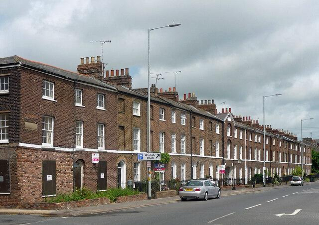
Source: Stephen Richards
London Road did not cause that growth by itself. Lynn’s population was rising and demand for housing was increasing. What the road provided was access. Land that had been peripheral could now be reached easily from one of the town’s principal thoroughfares. A road created to carry traffic became the backbone of a new neighbourhood.
The medieval gate fights back
There was an irony in all this. London Road had been built partly to make movement through Lynn easier, yet it funnelled increasing amounts of traffic towards a gateway constructed in the fifteenth century. The South Gate became a bottleneck.
In 1817 a pedestrian passage was cut through its eastern ground-floor chamber. Another was made on the western side in 1841. Pedestrians could now pass through without sharing the narrow central arch with carts and carriages, but the alterations came at the expense of medieval fabric. As nineteenth-century traffic increased, the gate itself came under threat. Lynn had demolished its East Gate in 1800, and there were those who regarded the South Gate as another inconvenient survivor. It escaped demolition.
In 1899 a new carriageway was created around its eastern side and the adjoining bridge was widened. The arrangement we see today is therefore a historical patchwork: a fifteenth-century gate, an early nineteenth-century road and a late Victorian solution to the congestion that the road helped create.
Finding the old road today
The easiest way to understand what London Road changed is not to stand in London Road at all. Walk instead from the centre through Bridge Street and All Saints Street, past All Saints’ Church and along Friars Street towards the South Gate. The changes of direction and narrower spaces give some sense of the route followed by travellers before the Georgian improvements. Then return to the gate and look north along London Road. The contrast is immediate.
There are other traces that require more imagination. Somewhere beneath the modern street lies the old course of the Millfleet. Material from the South Guanock Gate was incorporated into the road. Behind later shopfronts, the upper storeys of Georgian and early Victorian houses preserve the architectural character of the street that grew after the highway was opened.
London Road succeeded so completely that its creation has become almost invisible. It now seems the natural approach to the South Gate. It was nothing of the sort. In the first years of the nineteenth century, Lynn chose to abandon centuries of habit and cut a new route through fields, gardens, watercourses and the remains of its medieval defences. Traffic moved eastwards, builders followed and South Lynn expanded around the new highway.
The South Gate had once controlled entry into a medieval town. London Road turned it into the entrance to a modernising one.
© James Rye 2026
Book a Guided Tour with a Trained and Qualified King’s Lynn Guide
References
Borough Council of King’s Lynn and West Norfolk. King’s Lynn Urban Archaeological Database Project Report. King’s Lynn, 2022.
https://www.west-norfolk.gov.uk/download/downloads/id/7178/kings_lynn_urban_archaeological_database_project_report_-_march_2022.pdf
Borough Council of King’s Lynn and West Norfolk. The Friars Conservation Area Character Statement. King’s Lynn, 2008.
https://www.west-norfolk.gov.uk/download/downloads/id/1913/kings_lynn_the_friars_con_area_leafletpdf.pdf
Great Britain. An Act for Paving, Cleansing, Lighting, Watching, and Improving the Borough of King’s Lynn; for Removing Nuisances; and for Removing and Regulating the Saturday and Beast Markets. 43 Geo. III, c. 37. 1803.
https://www.legislation.gov.uk/ukla/Geo3/43/37
Great Britain. King’s Lynn Improvement Act 1806. 46 Geo. III, c. 21. 1806.
https://www.legislation.gov.uk/ukla/Geo3/46/21
Hillen, Henry J. History of the Borough of King’s Lynn. Vol. 2. Norwich: East of England Newspaper Company, 1907.
https://archive.org/details/historyofborough02hill
Historic England. “The South Gate, King’s Lynn.” National Heritage List for England, no. 1195304.
https://historicengland.org.uk/listing/the-list/list-entry/1195304
Norfolk County Council. “Site of South Guanock Gate.” Norfolk Heritage Explorer.
https://www.heritage.norfolk.gov.uk/