A ship could run aground in the Wash and its crew might feel, for a few hours, that they had been lucky. As the tide ebbed, they could climb down from the stranded vessel onto firm sand. The sea retreated around them. Yet they might still be miles from safety, cut off from the Norfolk or Lincolnshire shore by deep channels that could not be crossed on foot. Then the tide turned. Water began to creep back across the sand, their temporary island contracted, and eventually it disappeared. If their damaged vessel could not survive the returning sea, there was nowhere left to go.
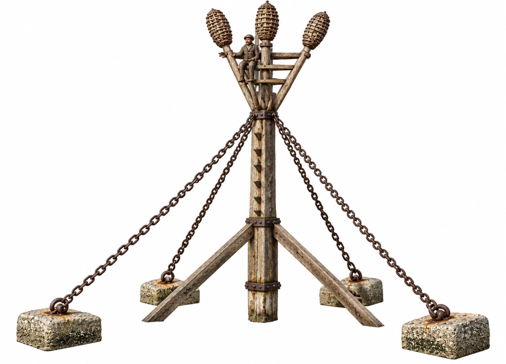
George Holditch knew these dangers better than most. He had spent years navigating and surveying the approaches to King’s Lynn, and by the early nineteenth century he had become one of the men responsible for helping other mariners find their way through them. His solution to the problem of sailors trapped on the sands was characteristically practical. He erected a beacon which did more than warn ships away from danger. If a vessel was wrecked, its crew could climb the structure and wait above the returning tide.
He called it a Life Beacon.
The man who mapped the channels
Holditch’s invention makes much more sense when set against the work he had already been doing for at least a decade. He was a pilot and hydrographic surveyor before he became known as an inventor, and his expertise was not confined to the immediate approaches to Lynn. In 1810 a chart was published covering the eastern coast of England from Orfordness in Suffolk to Flamborough Head in Yorkshire. It included Lynn and Boston Deeps and stated that it had been compiled partly from recent Trinity House surveys but “principally” from the surveys and remarks of George Holditch of Lynn Regis.
This was serious hydrographic work. A coastal chart had to give a mariner information that might determine whether his vessel reached harbour or struck a shoal. Holditch’s particular expertise lay in waters where fixed points on land offered only part of the answer. The Wash was continually being remade by tide and sediment. Sandbanks altered, channels migrated, and a route familiar to one generation of pilots could not simply be assumed to remain unchanged.
In May 1812 Holditch turned his attention specifically to Lynn’s West Channel. His chart was formally dedicated “To the Worshipfull the Mayor Alderman and Common Councel of Lynn Regis”, suggesting a close connection between his surveying and the corporation which governed the port. The original chart has not yet been traced, but a copy is recorded in the Historic England Archive.
Holditch therefore spent years studying precisely where the deep water ended and the dangerous sands began. He knew the buoys and beacons which marked the route, the soundings which told a pilot what lay beneath his vessel, and the landmarks used to establish position. He also knew how deceptive the Wash could be. At low water a sailor might see an immense landscape of exposed sand. A few hours later he would see only water.
It was within that disappearing landscape that Holditch found the problem his life-beacon was intended to solve.
When the shore could not help
Holditch was not alone in thinking about how lives might be saved after shipwreck. One of the best-known pioneers was another Norfolk man, Captain George William Manby. His apparatus used a mortar to fire a line from shore to a stranded vessel. Once the first line had reached the ship, heavier ropes and rescue equipment could be hauled across.
Holditch knew Manby and corresponded with him. In Manby’s published work he appears as “George Holditch, Pilot Master of Lynn”. The correspondence also provides a rare glimpse of Holditch’s own experience at sea. He remembered riding out a gale near St Abb’s Head in twelve fathoms of water with the stern of his vessel only about fifty yards from the rocks. People could be seen on those rocks, but they were powerless to help.
There was a painful simplicity to the problem. Rescuers and sailors might be within sight of one another and still be unable to bridge the water between them.
Manby’s apparatus attempted to bridge that gap. Holditch faced a more peculiar difficulty in the Wash because a wreck might occur miles from anything that could sensibly be called the shore. Men could find themselves standing on a sandbank surrounded by channels, too far out for Manby’s mortar, yet in a place which would itself soon be covered by the tide.
Holditch’s answer was not to find a way of bringing the shore to the sailors. It was to give them somewhere above the sea to wait.
A beacon that meant two things
By 1822 Holditch had erected his Life Beacon. This point is worth stressing because the invention has sometimes been described as though it were merely a proposal. The Society for the Encouragement of Arts, Manufactures, and Commerce published his account that year, and its own analytical index later referred specifically to a “Life Beacon, a, erected by Mr. G. Holditch”.
Holditch took something already familiar in the Wash and gave it an additional purpose. Beacons warned vessels about shoals and helped pilots identify their position among the channels. His beacon still performed that function, but it could also be climbed.
The transformation was conceptually small and practically ingenious. A structure which normally told sailors to keep away became, after a wreck, the place towards which they should run.
The sequence can be imagined easily enough. A vessel grounded as the tide fell. If it was badly damaged, the crew left it and crossed the exposed sand while they still could. They reached Holditch’s beacon and climbed. The tide then returned beneath them. Sand became shallow water and shallow water became sea. Their ship might break up nearby, but the men remained above the flood until rescuers arrived or the water fell again.
Unfortunately, we cannot yet describe the original structure in the detail it deserves. Holditch’s published account was illustrated, and his description was reprinted the following year in The Repertory of Arts, Manufactures, and Agriculture. The relevant contemporary plate has so far proved difficult to obtain at sufficient quality. It would be tempting to picture a small wooden hut raised on piles, but the surviving evidence does not yet justify that reconstruction.
A later description suggests that these structures could be surprisingly large. John Marius Wilson’s Imperial Gazetteer of England and Wales described the difficult fifteen-mile approach to Lynn as well buoyed and provided in one part with a life-beacon 34 feet high. At more than ten metres, it would have been a conspicuous object above the flat horizon of the Wash. We cannot assume that this later beacon was identical to Holditch’s original structure, but it shows how substantial the idea became.
An invention from Lynn
Holditch sent an account of his beacon to the Society of Arts in London, which rewarded practical inventions and improvements. The Society awarded him its Large Silver Medal and ten guineas.
That contemporary record corrects a mistake which has been repeated in Lynn histories. Henry Hillen later stated that Holditch received a gold medal from the Society in 1833. The Society’s own records show that the award was the Large Silver Medal and ten guineas, while Holditch’s description had already been published in 1822.
More interesting than the medal itself is what happened afterwards. Holditch continued to correspond with the Society. Its 1823 Transactions printed another letter from him, explicitly described as a continuation of his earlier communication about the Life Beacon. In 1824 the invention was brought before a still wider audience when the Mechanics’ Magazinepublished a two-page illustrated article, “Life Beacon at King’s Lynn Port”.
The magazine described Holditch as keeper of the buoys and beacons. That title brings his story neatly together. He had surveyed the channels, worked as a pilot, and become responsible for the physical marks which guided shipping through the Lynn approaches. His invention arose from the same work. Holditch understood both what a beacon normally did and what it might be made to do in an emergency.
The practical difficulties of building such a structure must have been considerable. Timber and ironwork had to withstand tides, waves, and weather. Materials had to be transported across shallow and shifting waters and the beacon erected on a bank which might be dry for only part of each tide. We do not yet know who paid for Holditch’s first structure. If Lynn Corporation financed it, the borough accounts may eventually reveal the carpenters, boatmen, materials, and payments involved in putting it on the sands.
Somewhere beyond King’s Lynn
One tantalising question remains unanswered: where exactly did the first Life Beacon stand?
It is surprisingly difficult to say. The sands and channels shown on a nineteenth-century chart cannot safely be matched with those on a modern map without allowing for two centuries of change. Even during Holditch’s lifetime the hydrography was changing sufficiently to require new surveys and corrections.
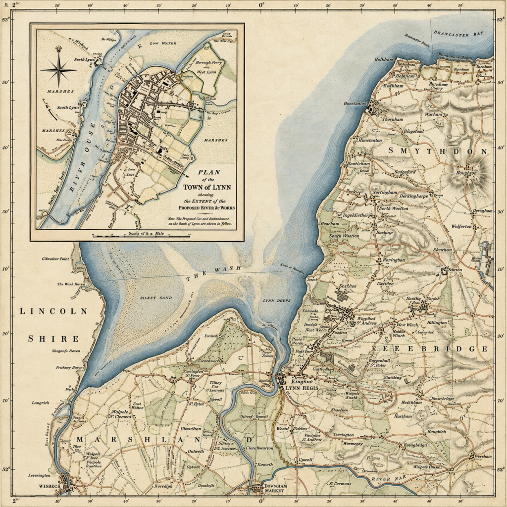
There is, however, a possible way through the problem. Holditch’s chart of Lynn West Channel was made in 1812, before his Life Beacon is known to have been erected. In 1828 Commander William Hewett RN carried out an Admiralty survey of Lynn and Boston Deeps. Hewett was therefore mapping the approaches only about six years after Holditch’s invention was published.
If a Life Beacon appears on that survey, comparison with Holditch’s earlier chart may allow its position to be identified. We might eventually be able to say not only which sand held the beacon but where it stood in relation to the channel followed by a ship leaving Lynn. Holditch’s earlier work on the West Channel makes that an obvious area to investigate, although the evidence is not yet sufficient to place the beacon there.
What is clearer is that the invention survived. Decades later, the 34-foot Life Beacon was still a recognised feature of the approaches to Lynn. Hillen also wrote that modified versions of Holditch’s design continued to stand on the sands of the Lynn Deeps. Hillen’s error over the medal means that his details require checking, but the independent evidence for a later Life Beacon supports his broader claim.
Holditch had not simply built an ingenious experimental structure. The principle was useful enough to endure.
Pilot, surveyor, and shipowner
Fragments from other records add substance to the man behind the invention. In 1826 the Lynn shipping registers recorded a cutter called the Rapid, built in the town by William Bottomley and measuring a little over 42 tons. Its owner was George Holditch, pilot, of Lynn, while John Thompson was its master.
We cannot yet say what Holditch did with the Rapid. It may have been connected with pilotage or surveying, or it may have been employed commercially. What matters is that Holditch was not observing Lynn’s maritime world from the quay. He worked within it, owned a substantial vessel, surveyed the waters through which ships approached the town, and held responsibility for some of the marks which guided them.
His family provides an unexpected contrast. His son Hamnet, born in Lynn in 1800 and educated at Lynn Grammar School, went to Gonville and Caius College, Cambridge. In 1822 Hamnet became Senior Wrangler, placing him first among Cambridge’s mathematics graduates, and won the first Smith’s Prize.
Father and son were therefore both receiving national recognition in the same year. Hamnet’s came from Cambridge mathematics. George’s came from the Society of Arts for a wooden structure standing somewhere among the sands outside Lynn.
There was mathematics in George’s world too, although of a more immediate kind. His calculations concerned bearings, distances, soundings, tides, and the plotting of channels. Errors could put a ship aground. Accurate observation could bring it safely home.
The Life Beacon belonged to that practical world. Holditch had spent years helping sailors avoid the sands, but he knew that charts, pilots, buoys, and beacons could never prevent every wreck. Ships would still ground. Storms would still overwhelm them. Men would still find themselves standing on a bank as the tide began to rise around their feet.
His originality lay in thinking beyond the moment when navigation had failed. Somewhere out in the Lynn Deeps, he turned a warning into a refuge.
© James Rye 2026
Book a Guided Tour with a Trained and Qualified King’s Lynn Guide Through Historic Lynn
References
Historic England Archive. “To the Worshipfull the Mayor Alderman and Common Councel of Lynn Regis. This Chart of Lynn West Channel…” George Holditch, May 1812. Ref. AO0720/19.
https://historicengland.org.uk/images-books/photos/item/AO0720/19
Holditch, George. “Description of a Life Beacon.” The Repertory of Arts, Manufactures, and Agriculture. 1823, 154–62.
https://books.google.com/books?id=lTRSAAAAYAAJ
Holditch, George. “Life Beacon.” Transactions of the Society, Instituted at London, for the Encouragement of Arts, Manufactures, and Commerce 40 (1822), 61 ff.
Holditch, George. Further communication concerning his Life Beacon. Transactions of the Society, Instituted at London, for the Encouragement of Arts, Manufactures, and Commerce 41 (1823), 290.
https://www.jstor.org/stable/41325899
Manby, George William. An Essay on the Preservation of Shipwrecked Persons. London. Includes correspondence from George Holditch, Pilot Master of Lynn.
https://archive.org/details/essayonpreservat00manbiala
Mechanics’ Magazine. “Life Beacon at King’s Lynn Port.” 1824.
UK Hydrographic Office. Lynn and Boston Deeps. Surveyed by Commander William Hewett RN, 1828. Admiralty Chart 108.
Wilson, John Marius. Imperial Gazetteer of England and Wales. 1870–72. Entry for Lynn.